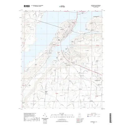
2020 Map of Guntersville
USGS Topo · Published 2020About this map
Guntersville Lake and the northern reaches of Albertville dominate this landscape, where the Tennessee River basin meets the plateau of Sand Mountain. The area is anchored by the Marshall County Courthouse, surrounded by industrial and residential clusters like Mill Village, Southtown, and Lakeview. A striking topographical feature is the Tennessee Valley Divide, which separates the northern drainage towards the lake from the southern headwaters of Hog Cr and Little Hog Cr.
Find a feature on this map
212 named features on this map. Tap any name to fly to it.
Don’t see what you’re looking for? This feature index may not catch every label — zoom into the map to look around manually.
Map Details
Editions of this 2020 Guntersville Map
This is the sole edition of this map. No revisions or reprints were ever made.
Other maps of this area

1885 · Gadsden
USGS Topo · 1:125,000

1888 · Gadsden
USGS Topo · 1:125,000

1892 · Gadsden
USGS Topo · 1:125,000

1895 · Gadsden
USGS Topo · 1:125,000

1903 · Gadsden
USGS Topo · 1:125,000

1936 · Guntersville
USGS Topo · 1:24,000

1936 · Mountainboro
USGS Topo · 1:24,000

1936 · Columbus City
USGS Topo · 1:24,000

1936 · Guntersville Dam
USGS Topo · 1:24,000

1936 · Arab
USGS Topo · 1:24,000
Featured Places
- Albertville, AL
- Guntersville, AL
- Lindsay Lane, Guntersville
- Mountain View, Guntersville
- Rayburn, Guntersville