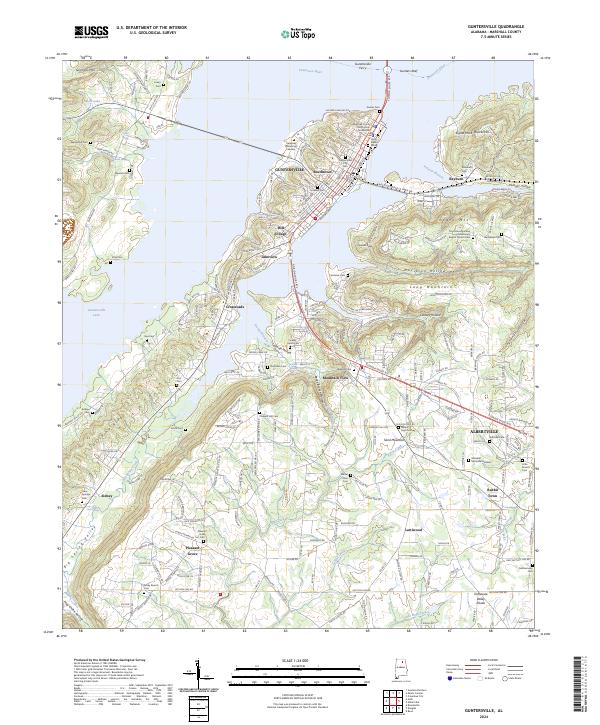
2024 Map of Guntersville
USGS Topo · Published 2024About this map
The Tennessee River snakes through the heart of Marshall County, Alabama, defining a landscape where the urban centers of Guntersville and Albertville meet the steep topography of Sand Mountain and Negro Mtn. Near the northern bend of the river, the Guntersville Ferry and Gunters Reef provide evidence of long-standing river navigation, while the Marshall County Courthouse serves as the civic anchor for the region. The map reveals a high density of rural burial sites and small communities, including Mill Village, Rabbit Town, and Lattiwood.
Find a feature on this map
72 named features on this map. Tap any name to fly to it.
Don’t see what you’re looking for? This feature index may not catch every label — zoom into the map to look around manually.
Map Details
Editions of this 2024 Guntersville Map
This is the sole edition of this map. No revisions or reprints were ever made.
Other maps of this area

1885 · Gadsden
USGS Topo · 1:125,000

1888 · Gadsden
USGS Topo · 1:125,000

1892 · Gadsden
USGS Topo · 1:125,000

1895 · Gadsden
USGS Topo · 1:125,000

1903 · Gadsden
USGS Topo · 1:125,000

1936 · Guntersville
USGS Topo · 1:24,000

1936 · Mountainboro
USGS Topo · 1:24,000

1936 · Columbus City
USGS Topo · 1:24,000

1936 · Guntersville Dam
USGS Topo · 1:24,000

1936 · Arab
USGS Topo · 1:24,000
Featured Places
- Albertville, AL
- Guntersville, AL
- Smith Shores, AL
- Lindsay Lane, Guntersville
- Mountain View, Guntersville