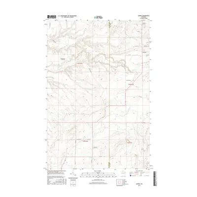
2015 Map of Gurney
USGS Topo · Published 2015About this map
Gurney and Sedgwick anchor this portion of the Wisconsin northwoods, a landscape defined by the drainage systems of the Potato River and Tyler Forks. The terrain is marked by significant topographical relief, most notably at Potato River Falls, where the river drops through a series of dramatic contours. Settled life in this rural corridor is tied to the roads that trace the section lines, such as Co Line Rd and Potato River Rd, connecting isolated homesteads and community landmarks. Genealogists can locate family sites through Edgewood Cem and Saint John's Lutheran Cem, while the intricate network of tributaries including Vaughn Cr, Barr Cr, and Gehrman Cr illustrates the complex hydrology that historically shaped the region's logging and agricultural potential.
Find a feature on this map
38 named features on this map. Tap any name to fly to it.
Don’t see what you’re looking for? This feature index may not catch every label — zoom into the map to look around manually.
Map Details
Editions of this 2015 Gurney Map
This is the sole edition of this map. No revisions or reprints were ever made.
Other maps of this area

1940 · Upson
USGS Topo · 1:48,000

1942 · Mellen
USGS Topo · 1:48,000

1943 · Upson
USGS Topo · 1:48,000

1943 · Little Girl Point
USGS Topo · 1:48,000

1943 · Odanah
USGS Topo · 1:48,000

1945 · Odanah
USGS Topo · 1:48,000

1945 · Mellen
USGS Topo · 1:48,000

1953 · Ashland
USGS Topo · 1:250,000
1956 · Saxon
USGS Topo · 1:24,000
1956 · Upson
USGS Topo · 1:24,000