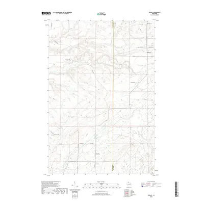
2018 Map of Gurney
USGS Topo · Published 2018About this map
The Potato River carves a deep path through the northern Wisconsin woods near the boundary of Ashland Co and Iron Co. This interior landscape is defined by its complex hydrography, including the Potato River Falls and the junction of numerous tributaries like Vaughn Cr, Winks Cr, and Feldcher Cr. The small settlements of Gurney and Sedgwick serve as the primary hubs in an area otherwise dominated by forestry and natural recreation, underscored by the presence of the N Country National Scenic Trail winding through the southwestern corner.
Find a feature on this map
32 named features on this map. Tap any name to fly to it.
Don’t see what you’re looking for? This feature index may not catch every label — zoom into the map to look around manually.
Map Details
Editions of this 2018 Gurney Map
This is the sole edition of this map. No revisions or reprints were ever made.
Other maps of this area

1940 · Upson
USGS Topo · 1:48,000

1942 · Mellen
USGS Topo · 1:48,000

1943 · Upson
USGS Topo · 1:48,000

1943 · Little Girl Point
USGS Topo · 1:48,000

1943 · Odanah
USGS Topo · 1:48,000

1945 · Odanah
USGS Topo · 1:48,000

1945 · Mellen
USGS Topo · 1:48,000

1953 · Ashland
USGS Topo · 1:250,000
1956 · Saxon
USGS Topo · 1:24,000
1956 · Upson
USGS Topo · 1:24,000