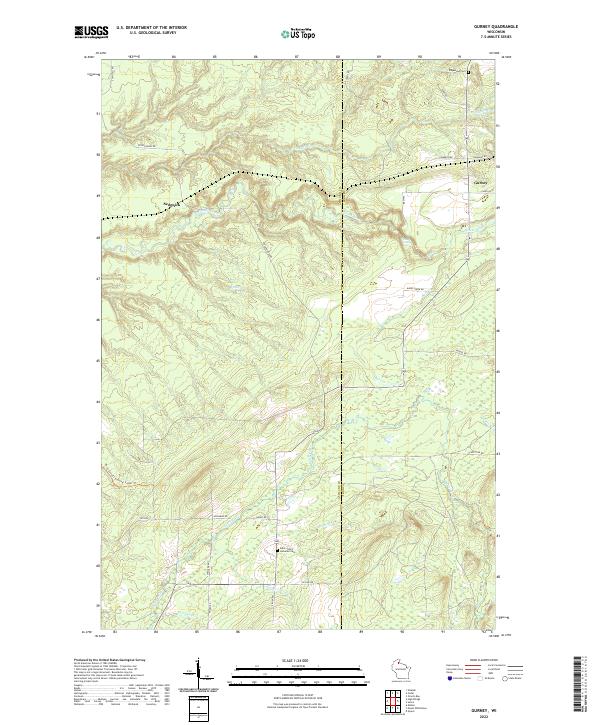
2022 Map of Gurney
USGS Topo · Published 2022About this map
The Potato River and its numerous tributaries, including Vaughn Cr and Tyler Forks, carve through the Northwoods of Ashland and Iron Counties. This modern survey illustrates the rugged drainage patterns of the region, featuring the Potato River Falls and a network of smaller streams like Winks Cr and Barr Cr. Human settlement is sparse and concentrated along rural corridors, with the small community of Gurney situated near the eastern boundary and the site of Sedgwick to the west. For local historians and genealogists, the map identifies key burial grounds such as Edgewood Cem and Saint John's Lutheran Cem. Recreational infrastructure is highlighted by the North Country National Scenic Trl, which meanders through the landscape, crossing numerous waterways and forest roads that define the area's contemporary accessibility.
Find a feature on this map
40 named features on this map. Tap any name to fly to it.
Don’t see what you’re looking for? This feature index may not catch every label — zoom into the map to look around manually.
Map Details
Editions of this 2022 Gurney Map
This is the sole edition of this map. No revisions or reprints were ever made.
Other maps of this area

1940 · Upson
USGS Topo · 1:48,000

1942 · Mellen
USGS Topo · 1:48,000

1943 · Upson
USGS Topo · 1:48,000

1943 · Little Girl Point
USGS Topo · 1:48,000

1943 · Odanah
USGS Topo · 1:48,000

1945 · Odanah
USGS Topo · 1:48,000

1945 · Mellen
USGS Topo · 1:48,000

1953 · Ashland
USGS Topo · 1:250,000
1956 · Saxon
USGS Topo · 1:24,000
1956 · Upson
USGS Topo · 1:24,000