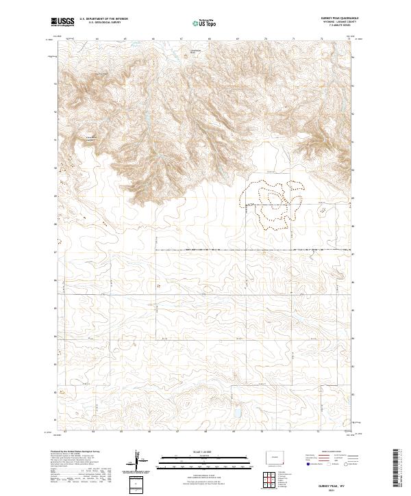
2021 Map of Gurney Peak
USGS Topo · Published 2021About this map
Gurney Peak rises as a prominent landmark in this corner of Laramie County, where the high plains meet broken breaks and drainage systems. This 2021 landscape is defined by its water management and agricultural infrastructure, notably the Petsch Reservoir in the northern reach. The terrain transitions from the steep descent of Lovercheck Canyon to the more gradual slopes surrounding Steamboat Rock. A network of intermittent drainages, including E Kellehan Cr and W Kellehan Cr, carves through the township lines, illustrating the natural catchment patterns of the region. Below the bluffs, the land opens into a grid of section-line roads such as Co Rd 158 and Strube Rd, marking the persistent boundaries of Wyoming's ranching and homesteading heritage. The presence of Bushnell Cr in the eastern edge further underscores the importance of seasonal water in this high-altitude environment.
Find a feature on this map
27 named features on this map. Tap any name to fly to it.
Don’t see what you’re looking for? This feature index may not catch every label — zoom into the map to look around manually.
Map Details
Editions of this 2021 Gurney Peak Map
This is the sole edition of this map. No revisions or reprints were ever made.
Other maps of this area

1899 · Goshen Hole
USGS Topo · 1:125,000

1954 · Cheyenne
USGS Topo · 1:250,000

1958 · Cheyenne
USGS Topo · 1:250,000

1960 · Tremain
USGS Topo · 1:24,000

1960 · Petsch Reservoir
USGS Topo · 1:24,000

1960 · Meriden
USGS Topo · 1:24,000

1963 · Lindbergh
USGS Topo · 1:24,000

1963 · Midway SE
USGS Topo · 1:24,000
1963 · Round Top
USGS Topo · 1:24,000

1963 · Gurney Peak
USGS Topo · 1:24,000