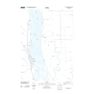
2013 Map of Guttenberg
USGS Topo · Published 2013About this map
The Mississippi River defines this landscape on the Iowa and Wisconsin border, where a complex network of side channels and islands creates a intricate riparian environment. The riverfront town of Guttenberg serves as a primary hub, home to the Iowa State Fish Aquarium and Hatchery and numerous street grids such as N Bluff St and N River Park Dr. Across the water in Wisconsin, the settlement of Glen Haven sits at the base of the bluffs, connected to the river by Dugway Rd. This modern survey reveals the hydrologic character of the Upper Mississippi, including named features like State Line Slough, Swift Slough, and Cassville Slough. Navigation and access are highlighted through the GAA Private Airport and the French Town Lake Access, while the surrounding terrain is marked by deep coulees such as Kline Hunt Hollow and Goodnuf Hollow Rd.
Find a feature on this map
94 named features on this map. Tap any name to fly to it.
Don’t see what you’re looking for? This feature index may not catch every label — zoom into the map to look around manually.
Map Details
Editions of this 2013 Guttenberg Map
This is the sole edition of this map. No revisions or reprints were ever made.
Other maps of this area

1900 · Lancaster
USGS Topo · 1:125,000

1902 · Elkader
USGS Topo · 1:125,000

1904 · Lancaster
USGS Topo · 1:125,000

1908 · Lancaster
USGS Topo · 1:125,000

1955 · Cassville
USGS Topo · 1:24,000

1957 · Turkey River
USGS Topo · 1:24,000

1957 · Colesburg
USGS Topo · 1:24,000

1959 · Dubuque
USGS Topo · 1:250,000

1961 · Dubuque
USGS Topo · 1:250,000

1962 · Dubuque
USGS Topo · 1:250,000