
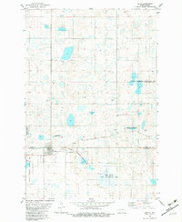
1982 Map of Guyson
USGS Topo · Published 1982About this map
Glacial potholes and small wetlands dominate this portion of the northern plains, reflecting a landscape defined by its conservation areas. Large segments of the terrain are designated as a National Waterfowl Production Area, highlighting the region's importance for migratory birds and local conservation efforts during the early 1980s. The northern border of the map features several namesake areas such as Janke and Haag, likely representing family-owned land tracts or local townships.
Find a feature on this map
11 named features on this map. Tap any name to fly to it.
Don’t see what you’re looking for? This feature index may not catch every label — zoom into the map to look around manually.
Map Details
Editions of this 1982 Guyson Map
This is the sole edition of this map. No revisions or reprints were ever made.
Other maps of this area

1953 · Jamestown
USGS Topo · 1:250,000

1956 · Jamestown
USGS Topo · 1:250,000

1982 · Coldwater Lake NW
USGS Topo · 1:24,000

1982 · Fredonia NW
USGS Topo · 1:24,000

1982 · Coldwater Lake NE
USGS Topo · 1:24,000

1982 · Fredonia
USGS Topo · 1:24,000

1982 · Lehr NE
USGS Topo · 1:24,000

1982 · Ashley NE
USGS Topo · 1:24,000

1982 · Fredonia NE
USGS Topo · 1:24,000
1982 · Lehr
USGS Topo · 1:24,000