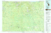
1983 Map of Gwinn
USGS Topo · Published 1983About this map
K I Sawyer Air Force Base dominates the central plateau of this Marquette County landscape, serving as a massive Cold War-era footprint amidst the dense woodlands of the Escanaba River State Forest. The map documents the heavy industrial heritage of the Upper Peninsula, particularly around the iron mining hubs of Ishpeming, Negaunee, and Palmer. Extensive mining infrastructure is evident through features like the Humboldt Mine (Tailings Pond), the National Mine, and the Greenwood Mine, alongside several smaller operations such as the Mackinaw Mine.
Find a feature on this map
113 named features on this map. Tap any name to fly to it.
Don’t see what you’re looking for? This feature index may not catch every label — zoom into the map to look around manually.
Map Details
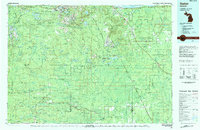
Editions of this 1983 Gwinn Map
2 editions found
Other maps of this area

1899 · Sagola
USGS Topo · 1:62,500

1899 · Witbeck
USGS Topo · 1:62,500

1907 · Marquette
USGS Topo · 1:62,500

1932 · Skandia SW
USGS Topo · 1:31,680

1932 · Gladstone NE
USGS Topo · 1:31,680

1932 · Rock SW
USGS Topo · 1:31,680

1932 · Helena NW
USGS Topo · 1:31,680

1932 · Trenary SW
USGS Topo · 1:31,680

1932 · Helena NE
USGS Topo · 1:31,680

1932 · Rock NE
USGS Topo · 1:31,680