
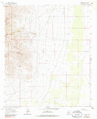
1964 Map of Gym Peak
USGS Topo · Published 1967About this map
Florida Mountains dominate the western portion of this 1960s survey, revealing a landscape defined by intensive mining activity and the essential search for water in the high desert. Prospectors and mining operations are scattered throughout the peaks and canyons, including the Florida Peak Mine near the northern summit and the Silver Cave Mine tucked within the interior. The presence of named shafts like Karanada Mines, Mahoney Mines, and San Tex Mine suggests a period of significant geological exploration and extraction.
Find a feature on this map
31 named features on this map. Tap any name to fly to it.
Don’t see what you’re looking for? This feature index may not catch every label — zoom into the map to look around manually.
Map Details
Editions of this 1964 Gym Peak Map
2 editions found
Other maps of this area

1899 · Deming
USGS Topo · 1:125,000

1915 · Deming
USGS Topo · 1:125,000

1917 · Camel Mountain
USGS Topo · 1:62,500

1917 · Columbus
USGS Topo · 1:62,500

1918 · Columbus
USGS Topo · 1:62,500

1920 · Columbus
USGS Topo · 1:62,500

1953 · El Paso
USGS Topo · 1:250,000

1955 · Las Cruces
USGS Topo · 1:250,000

1958 · Las Cruces
USGS Topo · 1:250,000

1959 · El Paso
USGS Topo · 1:250,000