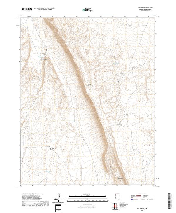
2021 Map of Gyp Pocket
USGS Topo · Published 2021About this map
The Hurricane Cliffs dominate this arid landscape in northern Mohave County, marking a dramatic geological transition between the plateau and the Lower Hurricane Valley. The area is characterized by its vital water management features, essential for sustaining life and livestock in this environment, including Gyp Pocket Tank, Ballard Tank, and Parker Tank. These isolated catchments and ponds like Nutter Pond are scattered across the terrain, reflecting the region's ranching heritage. Transport is defined by the Navajo Trail Rd, which snakes through the eastern section of the quadrangle. Distinctive landforms such as Gyp Pocket and the prominent rising feature known as The Grandstand provide unmistakable landmarks for those navigating the rugged drainage of Hurricane Wash.
Find a feature on this map
15 named features on this map. Tap any name to fly to it.
Don’t see what you’re looking for? This feature index may not catch every label — zoom into the map to look around manually.
Map Details
Editions of this 2021 Gyp Pocket Map
This is the sole edition of this map. No revisions or reprints were ever made.
Other maps of this area

1886 · Mt. Trumbull
USGS Topo · 1:250,000

1892 · Mt. Trumbull
USGS Topo · 1:250,000

1953 · Grand Canyon
USGS Topo · 1:250,000

1954 · Hurricane Cliffs 2 NW
USGS Topo · 1:24,000

1954 · Hurricane Cliffs 2 NE
USGS Topo · 1:24,000
1954 · Lost Spring NW
USGS Topo · 1:24,000
1954 · Lost Spring Mtn
USGS Topo · 1:62,500

1957 · Grand Canyon
USGS Topo · 1:250,000

1958 · Grand Canyon
USGS Topo · 1:250,000

1960 · Grand Canyon
USGS Topo · 1:250,000