
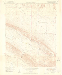
1949 Map of Gypsum Gap
USGS Topo · Published 1949About this map
The Atomic Energy Commission appears in the margin of this 1949 topographic study, signaling the era's focus on uranium and mineral resources in San Miguel County. The landscape is dominated by the broad Gypsum Valley and the neighboring Disappointment Valley, separated by a narrow passage at Gypsum Gap. Mining activity is evident along the valley slopes, with clusters of workings such as the Long Ridge Mines, Bald Eagle Mines, and Pitchfork Mines located near the water sources of Gypsum Creek. The presence of several Dams and water features like Larson Spring and a Flume illustrates the critical management of water for industrial and livestock use in this arid basin environment. Sparse infrastructure, mostly unimproved dirt roads, connects these remote mining operations to the surrounding plateau.
Find a feature on this map
14 named features on this map. Tap any name to fly to it.
Don’t see what you’re looking for? This feature index may not catch every label — zoom into the map to look around manually.
Map Details
Editions of this 1949 Gypsum Gap Map
2 editions found
Other maps of this area

1916 · Paradox Valley
USGS Topo · 1:125,000

1922 · Paradox Valley
USGS Topo · 1:125,000

1948 · Bull Canyon
USGS Topo · 1:24,000

1948 · Hamm Canyon
USGS Topo · 1:24,000

1948 · Naturita NW
USGS Topo · 1:24,000

1948 · Gypsum Gap
USGS Topo · 1:24,000

1949 · Bull Canyon
USGS Topo · 1:24,000

1949 · Naturita NW
USGS Topo · 1:24,000

1949 · Joe Davis Hill
USGS Topo · 1:24,000
1950 · Hamm Canyon
USGS Topo · 1:24,000