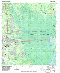
1993 Map of Haaswood
USGS Topo · Published 1995About this map
The intricate wetlands of the Pearl River State Wildlife Management Area dominate this landscape, where the Pearl River and West Pearl River fork through a complex network of bayous and islands. Along the western edge, the expansion of Slidell is evident through residential developments like Lake Village Blvd and institutional landmarks such as the Northshore Regional Medical Center.
Find a feature on this map
113 named features on this map. Tap any name to fly to it.
Don’t see what you’re looking for? This feature index may not catch every label — zoom into the map to look around manually.
Map Details
Editions of this 1993 Haaswood Map
2 editions found
Other maps of this area

1892 · Chef Menteur
USGS Topo · 1:62,500

1893 · Rigolets
USGS Topo · 1:62,500

1914 · Nicholson
USGS Topo · 1:62,500

1921 · Nicholson
USGS Topo · 1:62,500

1935 · Slidell
USGS Topo · 1:62,500

1935 · English Lookout
USGS Topo · 1:31,680

1936 · North Shore
USGS Topo · 1:31,680

1936 · Chef Menteur
USGS Topo · 1:62,500

1936 · Rigolets
USGS Topo · 1:62,500

1939 · Slidell
USGS Topo · 1:62,500