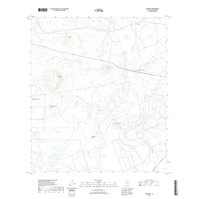
2019 Map of Hacienda
USGS Topo · Published 2019About this map
Hacienda anchors this stretch of Uvalde County, where the topography transitions from the winding course of the Nueces River into a landscape punctuated by numerous named peaks and ridges. The river is a primary corridor, crossed by the State Highway 3 Bridge and joined by tributaries such as Elm Cr and Mustang Cr. The presence of large-scale water features like Big Tank and Little Big Tank suggests a ranching environment dependent on managed water resources in this part of South Texas.
Find a feature on this map
22 named features on this map. Tap any name to fly to it.
Don’t see what you’re looking for? This feature index may not catch every label — zoom into the map to look around manually.
Map Details
Editions of this 2019 Hacienda Map
This is the sole edition of this map. No revisions or reprints were ever made.
Other maps of this area

1896 · Brackett
USGS Topo · 1:125,000

1897 · Brackett
USGS Topo · 1:125,000

1898 · Uvalde
USGS Topo · 1:125,000

1899 · Uvalde
USGS Topo · 1:125,000

1938 · Turkey Mountain
USGS Topo · 1:48,000

1943 · Turkey Mountain
USGS Topo · 1:62,500

1949 · Cline
USGS Topo · 1:62,500

1954 · San Antonio
USGS Topo · 1:250,000

1957 · San Antonio
USGS Topo · 1:250,000

1958 · Del Rio
USGS Topo · 1:250,000