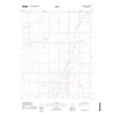
2019 Map of Hackamore Ranch
USGS Topo · Published 2019About this map
Hackamore Ranch serves as a primary landmark in this section of Bent County, where the high plains are deeply incised by the Purgatoire River. The river winds through the Picketwire Valley, a name reflecting the local corruption of the river's original French title. This landscape is defined by its complex drainage network, including notable features like Tarbox Arroyo, Rock Arroyo, and Mixon Canyon, which channel seasonal runoff toward the riverbed. Human efforts to manage the arid environment are evident in the presence of the Highland Canal and Farrington Spring. The map documents a sparsely populated ranching territory where traditional land use meets modern surveying, shown through the grid of section lines and isolated rural routes such as Co RD 8 and Co RD 7. It captures a quiet, working landscape where water sources and topographic breaks determine the placement of names and dwellings.
Find a feature on this map
29 named features on this map. Tap any name to fly to it.
Don’t see what you’re looking for? This feature index may not catch every label — zoom into the map to look around manually.
Map Details
Editions of this 2019 Hackamore Ranch Map
This is the sole edition of this map. No revisions or reprints were ever made.
Other maps of this area

1891 · Higbee
USGS Topo · 1:125,000

1891 · Las Animas
USGS Topo · 1:125,000

1893 · Higbee
USGS Topo · 1:125,000

1893 · Las Animas
USGS Topo · 1:125,000

1953 · Las Animas
USGS Topo · 1:24,000

1953 · Cornelia
USGS Topo · 1:24,000

1953 · Hadley
USGS Topo · 1:24,000

1954 · Lamar
USGS Topo · 1:250,000

1955 · La Junta
USGS Topo · 1:250,000

1958 · La Junta
USGS Topo · 1:250,000