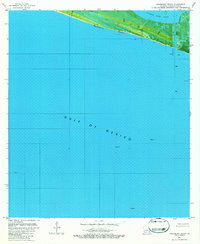
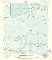
1982 Map of Hackberry Beach
USGS Topo · Published 1982About this map
Hackberry Beach stretches along the Louisiana coast in this orthophotomap, showing the thin ribbon of land separating the Gulf of Mexico from the wetlands of Lower Mud Lake. The imagery, based on aerial photography from the mid-1970s and edited in the early 1980s, highlights an industrial landscape defined by energy extraction and maritime navigation. Multiple offshore platforms and an inland Gas Well underscore the region's role in the petroleum industry, while numerous lights and beacons mark the shoreline for coastal traffic. This document is particularly valuable for researchers tracking coastal erosion and land loss in Cameron Parish, as it captures the precise positioning of the shoreline and the marshy inlet of Hog B before later decades of environmental change. The map's photographic base provides a literal view of the vegetation and sediment patterns of this coastal boundary during the early 1980s.
Find a feature on this map
11 named features on this map. Tap any name to fly to it.
Don’t see what you’re looking for? This feature index may not catch every label — zoom into the map to look around manually.
Map Details
Editions of this 1982 Hackberry Beach Map
This is the sole edition of this map. No revisions or reprints were ever made.
Other maps of this area

1934 · Grand Bayou
USGS Topo · 1:24,000

1935 · Grand Bayou
USGS Topo · 1:31,680

1935 · Bay Labauve
USGS Topo · 1:31,680

1935 · Grand Chenier
USGS Topo · 1:31,680

1946 · Hog Bayou NW
USGS Topo · 1:31,680
1949 · Hog Bayou NW
USGS Topo · 1:31,680

1954 · Port Arthur
USGS Topo · 1:250,000
1955 · Sweet Lake
USGS Topo · 1:62,500
1955 · Hog Bayou
USGS Topo · 1:62,500
1955 · Grand Lake West
USGS Topo · 1:62,500