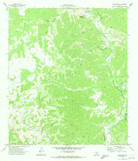
1971 Map of Hackberry
USGS Topo · Published 1974About this map
Hackberry and the surrounding Hill Country ranch land are defined by the intricate drainages feeding the Nueces River in the early 1970s. The landscape is a network of named draws and hollows, including Ruth Draw and Cade Hollow, where isolated settlements and landmarks like Laughlin appear alongside essential water sources such as Cade Spring and Kalentine Hole. The presence of several Landing Strips and numerous Jeep Trails underscores the necessity of aerial and off-road travel in this dissected terrain.
Find a feature on this map
35 named features on this map. Tap any name to fly to it.
Don’t see what you’re looking for? This feature index may not catch every label — zoom into the map to look around manually.
Map Details
Editions of this 1971 Hackberry Map
This is the sole edition of this map. No revisions or reprints were ever made.
Other maps of this area

1893 · Rock Springs
USGS Topo · 1:125,000

1893 · Nueces
USGS Topo · 1:125,000

1896 · Nueces
USGS Topo · 1:125,000

1947 · Hackberry
USGS Topo · 1:62,500

1954 · Llano
USGS Topo · 1:250,000

1954 · San Antonio
USGS Topo · 1:250,000

1954 · Sonora
USGS Topo · 1:250,000

1955 · Llano
USGS Topo · 1:250,000

1956 · Llano
USGS Topo · 1:250,000

1957 · San Antonio
USGS Topo · 1:250,000