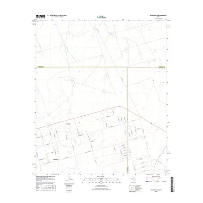
2016 Map of Hackberry Lake
USGS Topo · Published 2016About this map
The settlement of Gardendale anchors the southern portion of this West Texas landscape, where the Ector, Midland, and Andrews County lines converge. The grid-like street layout of the community, featuring botanical names like E Marigold St, E Poppy Dr, and E Goldenrod Dr, reflects a period of residential development and small-acreage subdivision. This residential pattern contrasts with the surrounding expanse of the Permian Basin, where infrastructure like Ranch Rd 1788 and FM 554 facilitates movement across the oil-rich terrain.
Find a feature on this map
55 named features on this map. Tap any name to fly to it.
Don’t see what you’re looking for? This feature index may not catch every label — zoom into the map to look around manually.
Map Details
Editions of this 2016 Hackberry Lake Map
This is the sole edition of this map. No revisions or reprints were ever made.
Other maps of this area

1954 · Hobbs
USGS Topo · 1:250,000

1954 · Pecos
USGS Topo · 1:250,000

1957 · Pecos
USGS Topo · 1:250,000

1958 · Hobbs
USGS Topo · 1:250,000

1964 · Odessa NE
USGS Topo · 1:24,000

1964 · Odessa NW
USGS Topo · 1:24,000

1965 · Southwest Midland
USGS Topo · 1:24,000

1966 · Mabee Ranch
USGS Topo · 1:24,000

1966 · Northwest Midland
USGS Topo · 1:24,000

1968 · Baird Lake
USGS Topo · 1:24,000