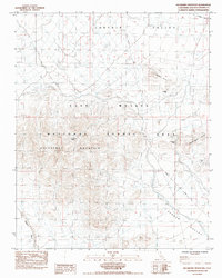
1984 Map of Hackberry Mountain
USGS Topo · Published 1986About this map
Hackberry Mountain and the surrounding high desert terrain are documented in this mid-1980s survey, showing a landscape defined by isolated water sources and mining history. The map records the True Blue Mine and California Mine tucked into the northern and eastern slopes, while vital desert water points like Hackberry Spring and Vontrigger Spring mark the transition between the mountain and the flanking Fenner Valley. The historical Government Road skirts the northern edge of Lanfair Valley, following an established path through the East Mojave National Scenic Area. This provisional survey provides a look at the desert floor before more modern mapping, showing the network of washes and trails that connected these remote mineral claims and springs.
Find a feature on this map
12 named features on this map. Tap any name to fly to it.
Don’t see what you’re looking for? This feature index may not catch every label — zoom into the map to look around manually.
Map Details
Editions of this 1984 Hackberry Mountain Map
2 editions found
Other maps of this area

1910 · Ivanpah
USGS Topo · 1:250,000

1912 · Ivanpah
USGS Topo · 1:250,000

1942 · Ivanpah
USGS Topo · 1:250,000

1942 · Amboy
USGS Topo · 1:250,000

1943 · Amboy
USGS Topo · 1:250,000

1943 · Fenner
USGS Topo · 1:62,500

1947 · Kingman
USGS Topo · 1:250,000

1948 · Kingman
USGS Topo · 1:250,000

1954 · Needles
USGS Topo · 1:250,000

1954 · Kingman
USGS Topo · 1:250,000