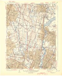
1940 Map of Hackensack
USGS Topo · Published 1940About this map
The Hackensack River and the Saddle River corridors anchor this pre-war survey of Bergen County, revealing a landscape transitioning from suburban estates to dense residential grids. The recently completed Oradell Reservoir dominates the eastern landscape, surrounded by emerging communities like Oradell, New Milford, and Dumont. The industrial and civic core of Hackensack is visible in high detail, featuring the Courthouse and Holy Name Hospital, while the Erie RR lines provide the primary infrastructure for commuters and local industry.
Find a feature on this map
73 named features on this map. Tap any name to fly to it.
Don’t see what you’re looking for? This feature index may not catch every label — zoom into the map to look around manually.
Map Details
Editions of this 1940 Hackensack Map
3 editions found
Other maps of this area

1888 · Paterson
USGS Topo · 1:62,500

1891 · Ramapo
USGS Topo · 1:62,500

1891 · Harlem
USGS Topo · 1:62,500

1892 · Paterson
USGS Topo · 1:62,500

1892 · Tarrytown
USGS Topo · 1:62,500

1893 · Tarrytown
USGS Topo · 1:62,500

1893 · Ramapo
USGS Topo · 1:62,500

1897 · Harlem
USGS Topo · 1:62,500

1898 · Harlem
USGS Topo · 1:62,500

1898 · Paterson
USGS Topo · 1:62,500