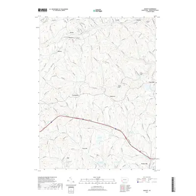
2019 Map of Hackett
USGS Topo · Published 2019About this map
Bentleyville and the surrounding townships in Washington County are defined by a complex network of valley-carved streams including Peters Cr, Mingo Cr, and N Br Pigeon Cr. The landscape is dotted with small settlements like Thomas, Munntown, and Kammerer, reflecting a long history of rural development and coal industry infrastructure. Significant industrial history is evident in the presence of the Mine Number Sixty Reservoir, while local heritage is preserved at landmarks like the Henry Covered Bridge and Ebenezer Covered Bridge. This modern survey details the transition between these traditional hamlets and newer infrastructure like the Finleyville Airpark and Bandel Airport. Genealogists can locate family sites near the Pigeon Creek Cem and Fairview Cem, situated among the winding ridges and creek branches that have shaped transit in this part of Pennsylvania for generations.
Find a feature on this map
135 named features on this map. Tap any name to fly to it.
Don’t see what you’re looking for? This feature index may not catch every label — zoom into the map to look around manually.
Map Details
Editions of this 2019 Hackett Map
This is the sole edition of this map. No revisions or reprints were ever made.
Other maps of this area

1901 · Amity
USGS Topo · 1:62,500

1902 · Brownsville
USGS Topo · 1:62,500

1904 · Amity
USGS Topo · 1:62,500

1904 · Mc Keesport
USGS Topo · 1:62,500

1904 · Carnegie
USGS Topo · 1:62,500

1906 · Brownsville
USGS Topo · 1:62,500

1906 · Carnegie
USGS Topo · 1:62,500

1907 · Pittsburg
USGS Topo · 1:62,500

1908 · Carnegie
USGS Topo · 1:62,500

1931 · Brownsville
USGS Topo · 1:62,500
Featured Places
- Bentleyville, PA
- North Strabane Township, PA
- Thomas, Nottingham Township
- Munntown, Nottingham Township
- Kammerer, Nottingham Township