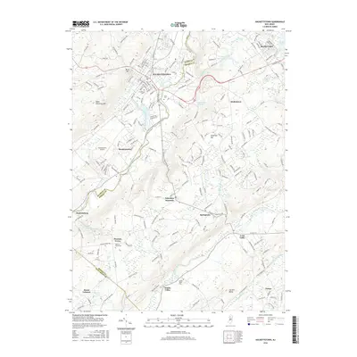
2016 Map of Hackettstown
USGS Topo · Published 2016About this map
Hackettstown serves as a primary hub where the Musconetcong River carves through the Highlands, marking the boundary between Warren and Morris counties. This mid-2010s survey details a landscape defined by sharp elevation changes, from the heights of Schooleys Mtn to the valley floors where historic settlements like Beattystown and Middle Valley reside. The presence of Centenary Coll and the Hackettstown Airport indicates the area's modern development, while numerous burial grounds such as Union Cem and Pleasant Grove Cem provide essential data points for local genealogists.
Find a feature on this map
220 named features on this map. Tap any name to fly to it.
Don’t see what you’re looking for? This feature index may not catch every label — zoom into the map to look around manually.
Map Details
Editions of this 2016 Hackettstown Map
This is the sole edition of this map. No revisions or reprints were ever made.
Other maps of this area

1888 · Hackettstown
USGS Topo · 1:62,500

1888 · Lake Hopatcong
USGS Topo · 1:62,500

1890 · High Bridge
USGS Topo · 1:62,500

1891 · Somerville
USGS Topo · 1:62,500

1893 · Somerville
USGS Topo · 1:62,500

1894 · Hackettstown
USGS Topo · 1:62,500

1894 · Lake Hopatcong
USGS Topo · 1:62,500

1898 · Lake Hopatcong
USGS Topo · 1:62,500

1898 · Hackettstown
USGS Topo · 1:62,500

1898 · High Bridge
USGS Topo · 1:62,500
Featured Places
- Mount Olive, NJ
- Hackettstown, NJ
- Long Valley, Washington Township
- Washington Township, NJ
- Lebanon Township, NJ