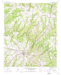
1946 Map of Hackleburg
USGS Topo · Published 1974About this map
Hackleburg serves as the focal point of this Northwest Alabama landscape, situated where the Illinois Central Railroad and the Tennessee Valley Divide Highway intersect. The map illustrates a rural society organized around family-named cemeteries and small community institutions, such as Lawler Cem, Cleveland Cem, and Gravel Hill Sch. The physical geography is defined by the Tennessee Valley Divide, which separates the winding Bear Creek and its many tributaries, like Mullins Creek and Bullock Branch, from the southern drainage of the Buttahatchee River. Local industry and infrastructure are represented by Nix Mill and historical crossings like Military Bridge and Prices Bridge. Small rural settlements like Duketon and Liberty Hill appear alongside numerous country churches, reflecting the early-to-mid 20th-century character of Marion and Franklin counties.
Find a feature on this map
52 named features on this map. Tap any name to fly to it.
Don’t see what you’re looking for? This feature index may not catch every label — zoom into the map to look around manually.
Map Details
Editions of this 1946 Hackleburg Map
3 editions found

Other maps of this area

1936 · Hodges
USGS Topo · 1:24,000

1936 · Isbell
USGS Topo · 1:24,000

1936 · Phil Campbell
USGS Topo · 1:24,000

1936 · South Of Hackleburg
USGS Topo · 1:24,000

1936 · Hackleburg
USGS Topo · 1:24,000

1936 · Spruce Pine
USGS Topo · 1:24,000

1936 · Goddard
USGS Topo · 1:24,000

1936 · Guinn Cross Roads
USGS Topo · 1:24,000

1945 · Spruce Pine
USGS Topo · 1:24,000
1945 · Isbell
USGS Topo · 1:24,000