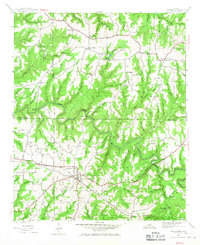
1946 Map of Hackleburg
USGS Topo · Published 1967About this map
The Illinois Central Railroad serves as a primary corridor through this section of the Alabama uplands, anchoring the town of Hackleburg. This survey captures the rural landscape shortly after World War II, revealing a dense network of family cemeteries and community landmarks such as Lawler Cem, Grissom Cem, and Lower Cem. The winding course of Bear Creek defines the local topography, featuring notable crossings like Prices Bridge and Military Bridge, the latter connected to the historic Military Road. Small agrarian settlements and centers of local life appear throughout the hills, including Nix Mill, Duketon, and Wiginton. The map provides excellent genealogical detail, marking numerous country churches like Adams Chapel and Antioch Ch, alongside schools such as Bullrock Sch, illustrating the dispersed settlement patterns of northwestern Alabama during the mid-20th century.
Find a feature on this map
78 named features on this map. Tap any name to fly to it.
Don’t see what you’re looking for? This feature index may not catch every label — zoom into the map to look around manually.
Map Details
Editions of this 1946 Hackleburg Map
3 editions found

Other maps of this area

1936 · Hodges
USGS Topo · 1:24,000

1936 · Isbell
USGS Topo · 1:24,000

1936 · Phil Campbell
USGS Topo · 1:24,000

1936 · South Of Hackleburg
USGS Topo · 1:24,000

1936 · Hackleburg
USGS Topo · 1:24,000

1936 · Spruce Pine
USGS Topo · 1:24,000

1936 · Goddard
USGS Topo · 1:24,000

1936 · Guinn Cross Roads
USGS Topo · 1:24,000

1945 · Spruce Pine
USGS Topo · 1:24,000
1945 · Isbell
USGS Topo · 1:24,000