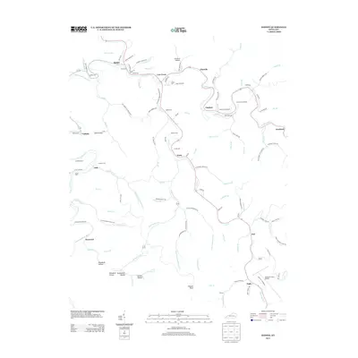
2013 Map of Haddix
USGS Topo · Published 2013About this map
The N Fork Kentucky River winds through this central Breathitt County landscape, where the confluence of numerous branches and creeks shaped a network of small valley communities. Remote settlements like Haddix, Lost Creek, and Watts are linked by winding roads that follow the natural topography of the hollers, such as Orchard Hollow and Broadtree Hollow. The map reveals a dense pattern of family and community history, evidenced by the numerous burial grounds scattered across the terrain, including the Teapoint Cemeteries, McIntosh Cemeteries, and the Haddix Cem. This concentration of namesake features like Tumbling Br and Stillhouse Br suggests a long-standing rural economy based on the resources of these Appalachian hills. In the southern reach of the quadrangle, the Wendell H Ford Airport and the village of Engle represent modern development alongside older crossings like Hardshell and Ned.
Find a feature on this map
118 named features on this map. Tap any name to fly to it.
Don’t see what you’re looking for? This feature index may not catch every label — zoom into the map to look around manually.
Map Details
Editions of this 2013 Haddix Map
This is the sole edition of this map. No revisions or reprints were ever made.
Other maps of this area

1889 · Salyersville
USGS Topo · 1:125,000

1891 · Hazard
USGS Topo · 1:125,000

1891 · Salyersville
USGS Topo · 1:125,000

1899 · Salyersville
USGS Topo · 1:125,000

1913 · Buckhorn
USGS Topo · 1:62,500

1914 · Troublesome
USGS Topo · 1:62,500

1951 · Guage
USGS Topo · 1:24,000

1951 · Quicksand
USGS Topo · 1:24,000

1951 · Jackson
USGS Topo · 1:24,000

1953 · Buckhorn
USGS Topo · 1:24,000