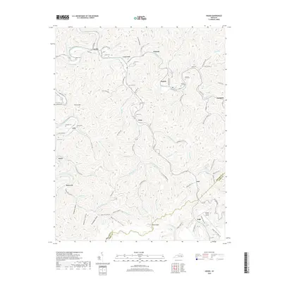
2019 Map of Haddix
USGS Topo · Published 2019About this map
The North Fork Kentucky River and Troublesome Creek carve a complex landscape of hollows and ridges throughout this 2019 survey. The area is defined by its numerous family-named cemeteries and landmarks, including Haddix Cem, Thorpe Cem, and McIntosh Cemeteries, which speak to the long-standing genealogical roots of this Breathitt County region. Several small communities are scattered along the narrow valley floors, notably Haddix, Lost Creek, and Hardshell.
Find a feature on this map
106 named features on this map. Tap any name to fly to it.
Don’t see what you’re looking for? This feature index may not catch every label — zoom into the map to look around manually.
Map Details
Editions of this 2019 Haddix Map
This is the sole edition of this map. No revisions or reprints were ever made.
Other maps of this area

1889 · Salyersville
USGS Topo · 1:125,000

1891 · Hazard
USGS Topo · 1:125,000

1891 · Salyersville
USGS Topo · 1:125,000

1899 · Salyersville
USGS Topo · 1:125,000

1913 · Buckhorn
USGS Topo · 1:62,500

1914 · Troublesome
USGS Topo · 1:62,500

1951 · Guage
USGS Topo · 1:24,000

1951 · Quicksand
USGS Topo · 1:24,000

1951 · Jackson
USGS Topo · 1:24,000

1953 · Buckhorn
USGS Topo · 1:24,000