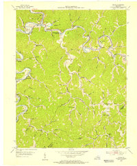
1954 Map of Haddix
USGS Topo · Published 1955About this map
The North Fork Kentucky River snakes through the deep valleys of the Cumberland Plateau, where the Louisville and Nashville RR follows its banks through settlements like Haddix and Whick. In the mid-1950s, this pocket of Breathitt County was defined by its reliance on the river and rail corridors for transport, with many small communities and post offices like Copland (Saldee PO) serving the local population. Higher in the hills, education and community life centered on a dense network of mountain schools and churches, including the Riverside Christian Training Sch and the Dessie Scott Sch located along the winding waters of Troublesome Creek. The landscape is etched with countless family landmarks, from the McIntosh Cems to the Thorpe Cem, revealing a deep-rooted genealogical history in the hollows and along the forks of Leatherwood Creek.
Find a feature on this map
88 named features on this map. Tap any name to fly to it.
Don’t see what you’re looking for? This feature index may not catch every label — zoom into the map to look around manually.
Map Details
Editions of this 1954 Haddix Map
This is the sole edition of this map. No revisions or reprints were ever made.
Other maps of this area

1889 · Salyersville
USGS Topo · 1:125,000

1891 · Hazard
USGS Topo · 1:125,000

1891 · Salyersville
USGS Topo · 1:125,000

1899 · Salyersville
USGS Topo · 1:125,000

1913 · Buckhorn
USGS Topo · 1:62,500

1914 · Troublesome
USGS Topo · 1:62,500

1951 · Guage
USGS Topo · 1:24,000

1951 · Quicksand
USGS Topo · 1:24,000

1951 · Jackson
USGS Topo · 1:24,000

1953 · Buckhorn
USGS Topo · 1:24,000