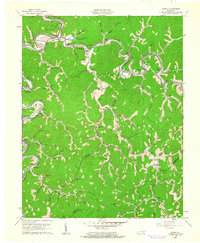
1961 Map of Haddix
USGS Topo · Published 1962About this map
Troublesome Creek and the North Fork Kentucky River define the winding valley landscape of this early 1960s survey. The area is characterized by scattered rural settlements and narrow hollows like Rye Cove Branch and Stillhouse Branch, where life centered around the Louisville and Nashville railroad lines. Local genealogy is deeply etched into the hillsides via numerous family burial grounds including Haddix Cem, Thorpe Cem, and Riverside Cem.
Find a feature on this map
74 named features on this map. Tap any name to fly to it.
Don’t see what you’re looking for? This feature index may not catch every label — zoom into the map to look around manually.
Map Details
Editions of this 1961 Haddix Map
This is the sole edition of this map. No revisions or reprints were ever made.
Other maps of this area

1889 · Salyersville
USGS Topo · 1:125,000

1891 · Hazard
USGS Topo · 1:125,000

1891 · Salyersville
USGS Topo · 1:125,000

1899 · Salyersville
USGS Topo · 1:125,000

1913 · Buckhorn
USGS Topo · 1:62,500

1914 · Troublesome
USGS Topo · 1:62,500

1951 · Guage
USGS Topo · 1:24,000

1951 · Quicksand
USGS Topo · 1:24,000

1951 · Jackson
USGS Topo · 1:24,000

1953 · Buckhorn
USGS Topo · 1:24,000