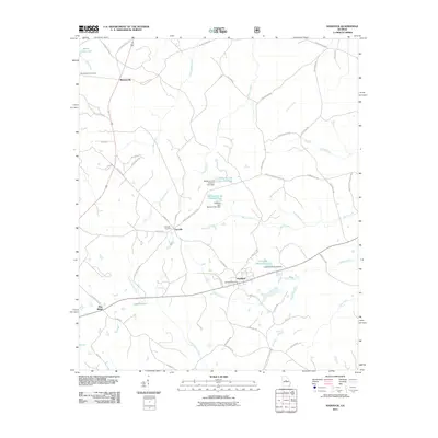
2011 Map of Haddock
USGS Topo · Published 2011About this map
The Haddock Post Office serves as a central landmark for this Jones County community, where the local landscape is defined by its rural road networks and a series of engineered water bodies. To the northwest, Blountsville sits at the junction of Blountsville Rd and Ellis Church Rd, illustrating the traditional settlement patterns of central Georgia. The map documents numerous impoundments, including Williams Lake Number One and Williams Lake Number Two, each marked with its respective dam.
Find a feature on this map
58 named features on this map. Tap any name to fly to it.
Don’t see what you’re looking for? This feature index may not catch every label — zoom into the map to look around manually.
Map Details
Editions of this 2011 Haddock Map
This is the sole edition of this map. No revisions or reprints were ever made.
Other maps of this area

1953 · Athens
USGS Topo · 1:250,000

1956 · Gordon
USGS Topo · 1:62,500

1956 · Macon
USGS Topo · 1:62,500

1957 · Macon
USGS Topo · 1:250,000

1958 · Macon
USGS Topo · 1:250,000

1958 · Athens
USGS Topo · 1:250,000

1959 · Athens
USGS Topo · 1:250,000

1963 · Athens
USGS Topo · 1:250,000

1964 · Macon
USGS Topo · 1:250,000

1964 · Gray
USGS Topo · 1:24,000