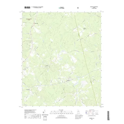
2020 Map of Haddock
USGS Topo · Published 2020About this map
The border of Jones and Baldwin counties runs through this part of middle Georgia, where a landscape of rolling terrain is defined by the drainage basins of Potato Cr and Commissioner Cr. The central settlement of Haddock sits at the junction of several local routes, serving as a hub for the surrounding rural communities of Fortville, Blountsville, and Pine Ridge. Cultural history is anchored at the Fortville Cem, while the northern portion of the quadrangle is largely occupied by the Oconee National Forest.
Find a feature on this map
77 named features on this map. Tap any name to fly to it.
Don’t see what you’re looking for? This feature index may not catch every label — zoom into the map to look around manually.
Map Details
Editions of this 2020 Haddock Map
This is the sole edition of this map. No revisions or reprints were ever made.
Other maps of this area

1953 · Athens
USGS Topo · 1:250,000

1956 · Gordon
USGS Topo · 1:62,500

1956 · Macon
USGS Topo · 1:62,500

1957 · Macon
USGS Topo · 1:250,000

1958 · Macon
USGS Topo · 1:250,000

1958 · Athens
USGS Topo · 1:250,000

1959 · Athens
USGS Topo · 1:250,000

1963 · Athens
USGS Topo · 1:250,000

1964 · Macon
USGS Topo · 1:250,000

1964 · Gray
USGS Topo · 1:24,000