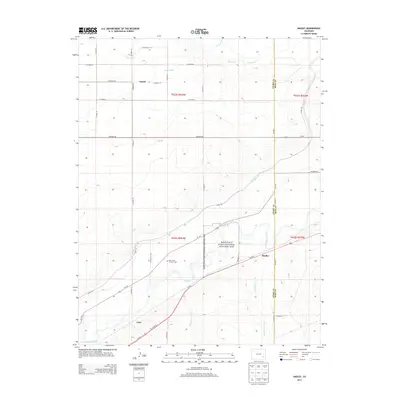
2013 Map of Hadley
USGS Topo · Published 2013About this map
Bent's Old Fort National Historic Site anchors this portion of the Arkansas River valley, preserving a critical focal point of early trade and frontier history along the Arkansas River. The landscape is defined by its complex irrigation network, necessary for agriculture in this high plains environment, featuring the Fort Lyon Canal, Lewis Lateral, and several unnamed canal roads that crisscross the terrain. Small settlements and local landmarks provide a look at rural life in the Otero and Bent County borderlands, including the community of Hadley and the outlying area of Castiel. Genealogists and local historians will find the Saint Paul's Lutheran Cem near the river, while the natural drainage of the land is marked by deep incisions like Robinson Arroyo and Vandiver Arroyo flowing toward the valley floor.
Find a feature on this map
35 named features on this map. Tap any name to fly to it.
Don’t see what you’re looking for? This feature index may not catch every label — zoom into the map to look around manually.
Map Details
Editions of this 2013 Hadley Map
This is the sole edition of this map. No revisions or reprints were ever made.
Other maps of this area

1891 · Catlin
USGS Topo · 1:125,000

1891 · Higbee
USGS Topo · 1:125,000

1891 · Las Animas
USGS Topo · 1:125,000

1891 · Timpas
USGS Topo · 1:125,000

1893 · Higbee
USGS Topo · 1:125,000

1893 · Las Animas
USGS Topo · 1:125,000

1893 · Catlin
USGS Topo · 1:125,000

1894 · Timpas
USGS Topo · 1:125,000

1953 · Cheraw
USGS Topo · 1:24,000

1953 · Cornelia
USGS Topo · 1:24,000