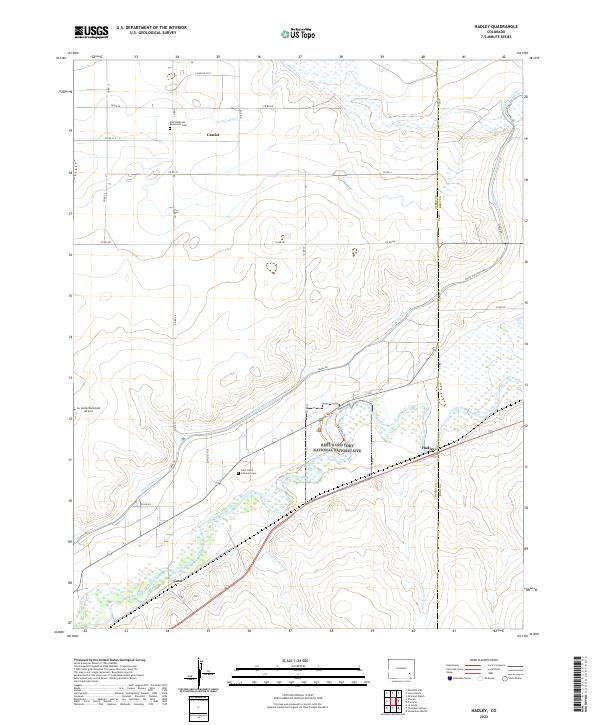
2022 Map of Hadley
USGS Topo · Published 2022About this map
The Arkansas River corridor in Otero County defines this landscape, where the Bent's Old Fort National Historic Site preserves a critical 19th-century trading post location. This modern survey illustrates the enduring agricultural infrastructure of the High Plains, dominated by the winding Fort Lyon Canal and secondary irrigation features like the Lewis Lateral. Small settlements and rural community hubs, including Castiel, Hadley, and Casa, are mapped alongside essential local markers for genealogists and historians. Notable religious and burial sites like the East Holbrook Mennonite Cem and Saint Paul's Lutheran Cem speak to the area's pioneer heritage. To the west, the La Junta Municipal Airport stands near the river, while the complex drainage systems of Vandiver Arroyo and Robinson Arroyo cut through the terrain toward the main river valley.
Find a feature on this map
39 named features on this map. Tap any name to fly to it.
Don’t see what you’re looking for? This feature index may not catch every label — zoom into the map to look around manually.
Map Details
Editions of this 2022 Hadley Map
This is the sole edition of this map. No revisions or reprints were ever made.
Other maps of this area

1891 · Catlin
USGS Topo · 1:125,000

1891 · Higbee
USGS Topo · 1:125,000

1891 · Las Animas
USGS Topo · 1:125,000

1891 · Timpas
USGS Topo · 1:125,000

1893 · Higbee
USGS Topo · 1:125,000

1893 · Las Animas
USGS Topo · 1:125,000

1893 · Catlin
USGS Topo · 1:125,000

1894 · Timpas
USGS Topo · 1:125,000

1953 · Cheraw
USGS Topo · 1:24,000

1953 · Cornelia
USGS Topo · 1:24,000