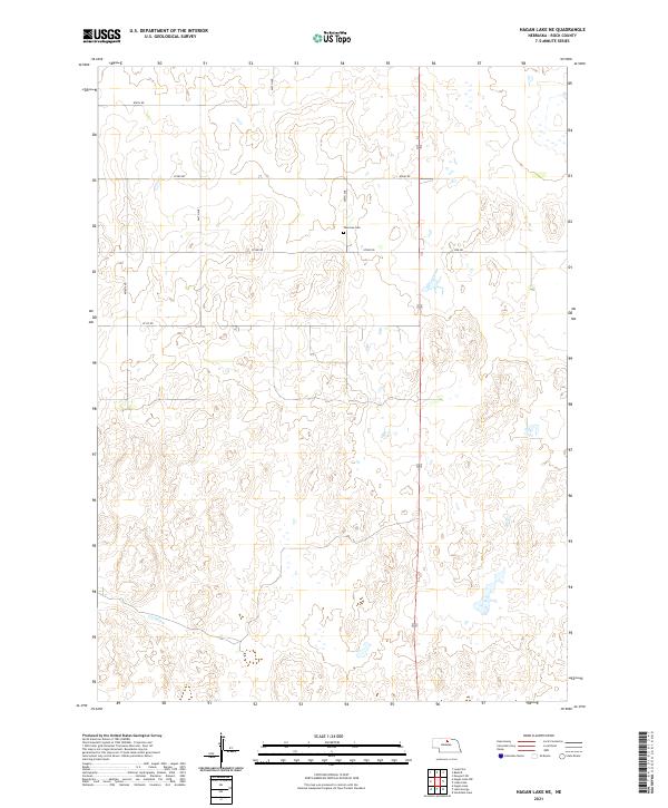
2021 Map of Hagan Lake NE
USGS Topo · Published 2021About this map
Thurman Cem stands as a solitary named landmark within this section of Rock County, reflecting the sparse settlement patterns of north-central Nebraska. The landscape is primarily defined by the Public Land Survey System grid, which governs the placement of local thoroughfares like 874th Rd and 871st Rd. The presence of Wpa Rd provides a subtle nod to mid-20th-century public works history, indicating where federal labor programs helped establish the rural infrastructure that still serves these cattle-grazing lands and isolated homesteads today. This 2021 update preserves the exact spatial relationship between the township boundaries of T29N and T28N, where they meet the R20W and R19W ranges, offering a precise look at modern land division in a region dominated by sweeping natural contours.
Find a feature on this map
10 named features on this map. Tap any name to fly to it.
Don’t see what you’re looking for? This feature index may not catch every label — zoom into the map to look around manually.
Map Details
Editions of this 2021 Hagan Lake NE Map
This is the sole edition of this map. No revisions or reprints were ever made.
Other maps of this area

1954 · Long Pine
USGS Topo · 1:24,000

1954 · Bassett
USGS Topo · 1:24,000

1954 · Newport SW
USGS Topo · 1:24,000

1955 · O'Neill
USGS Topo · 1:250,000

1959 · O'Neill
USGS Topo · 1:250,000

1969 · O'Neill
USGS Topo · 1:250,000
1982 · Linke Lake
USGS Topo · 1:24,000

1982 · Hagan Lake NE
USGS Topo · 1:24,000

1982 · Stockdale Lake
USGS Topo · 1:24,000
1982 · Lake George
USGS Topo · 1:24,000