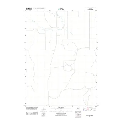
2011 Map of Hagan Lake NW
USGS Topo · Published 2011About this map
Long Pine Creek meanders through this portion of Rock County, carving a distinct drainage pattern across the high plains of north-central Nebraska. The watercourse is joined by Spring Branch, reflecting the essential role of surface water in this sparsely settled prairie landscape. This 2011 survey reveals a vast network of local roads and sections, illustrating the geometric land divisions typical of the American West. The lack of named settlements or clusters of structures emphasizes the rural and agricultural character of the region, where the terrain is defined by the subtle elevation changes of the Sandhills and the vital riparian corridors that support the area's cattle ranching economy.
Find a feature on this map
2 named features on this map. Tap any name to fly to it.
Don’t see what you’re looking for? This feature index may not catch every label — zoom into the map to look around manually.
Map Details
Editions of this 2011 Hagan Lake NW Map
This is the sole edition of this map. No revisions or reprints were ever made.
Other maps of this area

1954 · Ainsworth
USGS Topo · 1:24,000

1954 · Long Pine
USGS Topo · 1:24,000

1954 · Bassett
USGS Topo · 1:24,000

1955 · O'Neill
USGS Topo · 1:250,000

1959 · O'Neill
USGS Topo · 1:250,000

1969 · O'Neill
USGS Topo · 1:250,000

1982 · Hagan Lake NE
USGS Topo · 1:24,000

1982 · Hofeld Lake
USGS Topo · 1:24,000

1982 · Raven
USGS Topo · 1:24,000
1982 · Lake George
USGS Topo · 1:24,000