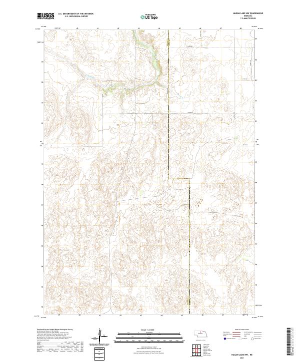
2021 Map of Hagan Lake NW
USGS Topo · Published 2021About this map
Long Pine Cr and Spring Br carve through the landscape along the Brown Co Rock Co border, illustrating the sparse settlement patterns of this Nebraska region in the early twenty-first century. The map depicts a structured network of section-line roads, including 874th Rd and 441st Ave, which define the agricultural and ranching layout of the Sandhills. Produced by the U.S. Geological Survey, this survey details the topography of townships T29N R21W and T29N R20W, where the terrain is marked by subtle elevation changes and drainages. The absence of concentrated town centers highlights the rural nature of the area, where land use is dictated by the water courses and the rigid grid of the public land survey system.
Find a feature on this map
15 named features on this map. Tap any name to fly to it.
Don’t see what you’re looking for? This feature index may not catch every label — zoom into the map to look around manually.
Map Details
Editions of this 2021 Hagan Lake NW Map
This is the sole edition of this map. No revisions or reprints were ever made.
Other maps of this area

1954 · Ainsworth
USGS Topo · 1:24,000

1954 · Long Pine
USGS Topo · 1:24,000

1954 · Bassett
USGS Topo · 1:24,000

1955 · O'Neill
USGS Topo · 1:250,000

1959 · O'Neill
USGS Topo · 1:250,000

1969 · O'Neill
USGS Topo · 1:250,000

1982 · Hagan Lake NE
USGS Topo · 1:24,000

1982 · Hofeld Lake
USGS Topo · 1:24,000

1982 · Raven
USGS Topo · 1:24,000
1982 · Lake George
USGS Topo · 1:24,000