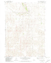
1982 Map of Hagan Lake NW
USGS Topo · Published 1982About this map
Long Pine Creek and its tributary Spr Branch carve through the north-central portion of this landscape along the border of Brown and Rock Counties. The terrain is characterized by a high concentration of ranching operations, reflecting the area's agricultural reliance on the Nebraska Sandhills. Named holdings such as Duffy Ranch, Stee Ranch, and Darlington Ranch are scattered across the quadrangle, serving as vital landmarks for local family historians and genealogists.
Find a feature on this map
12 named features on this map. Tap any name to fly to it.
Don’t see what you’re looking for? This feature index may not catch every label — zoom into the map to look around manually.
Map Details
Editions of this 1982 Hagan Lake NW Map
This is the sole edition of this map. No revisions or reprints were ever made.
Other maps of this area

1954 · Ainsworth
USGS Topo · 1:24,000

1954 · Long Pine
USGS Topo · 1:24,000

1954 · Bassett
USGS Topo · 1:24,000

1955 · O'Neill
USGS Topo · 1:250,000

1959 · O'Neill
USGS Topo · 1:250,000

1969 · O'Neill
USGS Topo · 1:250,000

1982 · Hagan Lake NE
USGS Topo · 1:24,000

1982 · Hofeld Lake
USGS Topo · 1:24,000

1982 · Raven
USGS Topo · 1:24,000
1982 · Lake George
USGS Topo · 1:24,000