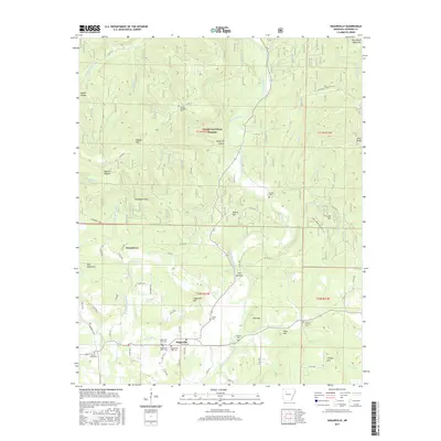
2017 Map of Hagarville
USGS Topo · Published 2017About this map
Hagarville serves as the focal point of this Johnson County landscape, situated where the terrain begins to climb into the Ozark National Forest. The geography is defined by a series of prominent ridges and peaks, including Hagarville Mtn and Saul Mtn, which frame the winding passage of Little Piney Creek. The map reveals a high concentration of small family and community burial grounds, such as Hagarville West Cem, Hagarville East Cem, and Adkins Cem, which are often located near local road junctions or on elevated ground like Tater Hill. This pattern of scattered cemeteries and small named localities like Strawberry and Chalybeate Spur reflects a long history of rural settlement where residents lived in the hollows and along the creek branches. Farther north, the terrain becomes more dramatic with features like The Narrows and Pilot Rock Mountain marking the transition into the protected forest lands.
Find a feature on this map
82 named features on this map. Tap any name to fly to it.
Don’t see what you’re looking for? This feature index may not catch every label — zoom into the map to look around manually.
Map Details
Editions of this 2017 Hagarville Map
This is the sole edition of this map. No revisions or reprints were ever made.
Other maps of this area

1888 · Dardanelle #2
USGS Topo · 1:62,500

1888 · Dardanelle #1
USGS Topo · 1:62,500

1889 · Treat
USGS Topo · 1:62,500

1889 · Ozone
USGS Topo · 1:62,500

1890 · Dardanelle
USGS Topo · 1:125,000

1932 · Treat
USGS Topo · 1:62,500

1934 · Treat
USGS Topo · 1:62,500

1934 · Ozone
USGS Topo · 1:62,500

1936 · Ozone
USGS Topo · 1:62,500

1956 · Russellville
USGS Topo · 1:250,000