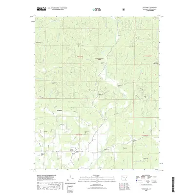
2020 Map of Hagarville
USGS Topo · Published 2020About this map
Hagarville serves as the focal point of this rural Johnson County landscape, situated where the terrain begins its ascent into the southern reaches of the Ozark National Forest. The settlement pattern is defined by family-named landmarks and numerous small burial grounds, including Hagarville West Cem and Annis Chapel Cem, reflecting the deep-rooted local history of this region. The landscape is deeply dissected by a network of waterways such as Little Piney Creek and Granny Cr, which have shaped the movement and development of the area. Notable geological features like The Narrows and named summits like Pilot Rock Mountain provide a clear view of the transition from the valley floor to the forested uplands. The distribution of cemeteries, such as Minnow Creek Cem and Woods Mountain Cem, offers valuable evidence for genealogists and local historians tracing the settlement of Strawberry and surrounding hillsides.
Find a feature on this map
82 named features on this map. Tap any name to fly to it.
Don’t see what you’re looking for? This feature index may not catch every label — zoom into the map to look around manually.
Map Details
Editions of this 2020 Hagarville Map
This is the sole edition of this map. No revisions or reprints were ever made.
Other maps of this area

1888 · Dardanelle #2
USGS Topo · 1:62,500

1888 · Dardanelle #1
USGS Topo · 1:62,500

1889 · Treat
USGS Topo · 1:62,500

1889 · Ozone
USGS Topo · 1:62,500

1890 · Dardanelle
USGS Topo · 1:125,000

1932 · Treat
USGS Topo · 1:62,500

1934 · Treat
USGS Topo · 1:62,500

1934 · Ozone
USGS Topo · 1:62,500

1936 · Ozone
USGS Topo · 1:62,500

1956 · Russellville
USGS Topo · 1:250,000