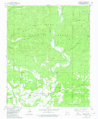
1980 Map of Hagarville
USGS Topo · Published 1980About this map
Hagarville serves as the primary settlement in this 1980 survey, situated at the base of Hagarville Mountain where several streams converge. The landscape is defined by the dense drainage network of the Ozark National Forest, including the winding path of Little Piney Creek and its many tributaries like Minnow Creek and Granny Creek. Local genealogy and community history are well-preserved through numerous rural burial sites and landmarks, such as Hagarville West Cem, Newton Cem, and Woods Mountain Cem. Notable religious sites include Annies Chapel and Lees Chapel, which provided social centers for the residents of the hollows. Elevation changes are marked by prominent peaks such as Pilot Rock Mountain and Ozone Mountain, while the distinct geography of The Narrows highlights the constricted water gaps characteristic of the region.
Find a feature on this map
45 named features on this map. Tap any name to fly to it.
Don’t see what you’re looking for? This feature index may not catch every label — zoom into the map to look around manually.
Map Details
Editions of this 1980 Hagarville Map
This is the sole edition of this map. No revisions or reprints were ever made.
Other maps of this area

1888 · Dardanelle #2
USGS Topo · 1:62,500

1888 · Dardanelle #1
USGS Topo · 1:62,500

1889 · Treat
USGS Topo · 1:62,500

1889 · Ozone
USGS Topo · 1:62,500

1890 · Dardanelle
USGS Topo · 1:125,000

1932 · Treat
USGS Topo · 1:62,500

1934 · Treat
USGS Topo · 1:62,500

1934 · Ozone
USGS Topo · 1:62,500

1936 · Ozone
USGS Topo · 1:62,500

1956 · Russellville
USGS Topo · 1:250,000