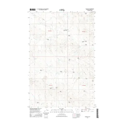
2017 Map of Hagen Gap
USGS Topo · Published 2017About this map
Hagen Gap serves as a central landmark in this high plains landscape of Garfield County, defined by an intricate network of intermittent drainages known locally as coulees. The terrain is shaped by Woody Creek and its various branches, including the East Fork Woody Creek, which carve through the dry earth. Human presence is marked by a series of small water management features such as Burgess Reservoir, Mullory Reservoir, and Cottonwood Reservoir, essential for ranching in this arid environment. The map details numerous named topographic features with ties to local landholders and history, such as Lambs Butte and Nannestead Coulee. Navigation through the area is primarily facilitated by rugged routes like Burgess Rd, which connects the scattered livestock reservoirs across the township boundaries of T20N and T19N.
Find a feature on this map
38 named features on this map. Tap any name to fly to it.
Don’t see what you’re looking for? This feature index may not catch every label — zoom into the map to look around manually.
Map Details
Editions of this 2017 Hagen Gap Map
This is the sole edition of this map. No revisions or reprints were ever made.
Other maps of this area

1954 · Jordan
USGS Topo · 1:250,000

1956 · Jordan
USGS Topo · 1:250,000

1958 · Jordan
USGS Topo · 1:250,000

1964 · Jordan
USGS Topo · 1:250,000

1964 · Ada Creek
USGS Topo · 1:24,000

1964 · Bateman Coulee NE
USGS Topo · 1:24,000

1967 · Hagen Gap
USGS Topo · 1:24,000
1967 · Maxwell Coulee
USGS Topo · 1:24,000

1967 · Coal Creek
USGS Topo · 1:24,000

1967 · Frank Coulee
USGS Topo · 1:24,000