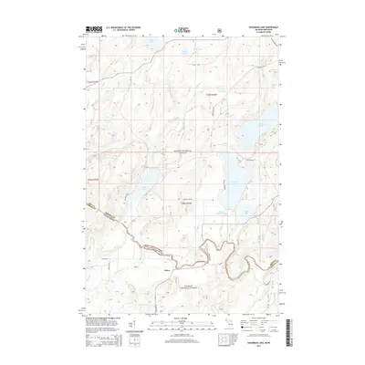
2014 Map of Hagerman Lake
USGS Topo · Published 2014About this map
The Brule River defines the winding state line between Michigan and Wisconsin, flowing through a landscape dominated by the Ottawa National Forest and Nicolet National Forest. This remote forest region is centered around the small settlement of Nelma, situated near the intersection of State Hwy 55 and Lena Rd. The map reveals a dense network of glacial lakes and waterways, including the large Hagerman Lake and the nearby Ottawa Lake, which is accessible via Lake Ottawa Rd.
Find a feature on this map
48 named features on this map. Tap any name to fly to it.
Don’t see what you’re looking for? This feature index may not catch every label — zoom into the map to look around manually.
Map Details
Editions of this 2014 Hagerman Lake Map
This is the sole edition of this map. No revisions or reprints were ever made.
Other maps of this area

1898 · Iron River
USGS Topo · 1:62,500

1938 · Alvin
USGS Topo · 1:48,000

1939 · Long Lake
USGS Topo · 1:48,000

1944 · Iron River
USGS Topo · 1:24,000

1945 · Gibbs City
USGS Topo · 1:24,000

1946 · Iron River
USGS Topo · 1:31,680

1946 · Alvin
USGS Topo · 1:48,000

1946 · Gibbs City
USGS Topo · 1:31,680

1948 · Long Lake
USGS Topo · 1:48,000

1954 · Iron Mountain
USGS Topo · 1:250,000