
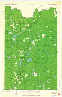
1939 Map of Long Lake
USGS Topo · Published 1957About this map
The timber and recreation landscape of northeastern Wisconsin is meticulously charted here shortly before the onset of World War II. Centered on the sprawling Halsey Lake and Long Lake, the area is defined by the intersection of the Chicago and Northwestern railroad and the Nicolet National Forest. This era shows a transition from active resource extraction to forest management and tourism, evidenced by the Long Lake CCC Camp and waterfront properties like Kloks Resort.
Find a feature on this map
75 named features on this map. Tap any name to fly to it.
Don’t see what you’re looking for? This feature index may not catch every label — zoom into the map to look around manually.
Map Details
Editions of this 1939 Long Lake Map
2 editions found
Other maps of this area

1898 · Iron River
USGS Topo · 1:62,500

1899 · Crystal Falls
USGS Topo · 1:62,500

1938 · Alvin
USGS Topo · 1:48,000

1939 · Crandon
USGS Topo · 1:48,000

1939 · Goodman
USGS Topo · 1:48,000

1939 · Laona
USGS Topo · 1:48,000

1941 · Florence
USGS Topo · 1:48,000

1941 · Crandon
USGS Topo · 1:48,000

1944 · Iron River
USGS Topo · 1:24,000

1944 · Gaastra
USGS Topo · 1:24,000