
1939 Map of Laona
USGS Topo · Published 1956About this map
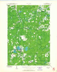
The timber and rail economy of Forest County takes center stage in this 1939 survey, centered on the lumber hub of Laona. The town is the most developed settlement on the map, situated between Silver Lake and Scattered Rice Lake. The landscape is defined by the intersection of major rail lines, including the Chicago and Northwestern Railway and the Minneapolis Sault Ste Marie and Atlantic Railway, which served the region's logging industry. Strategic surveillance of the Nicolet National Forest is evident through the Laona Fire Tower and Newald Fire Tower. To the south, a CCC Camp near Blackwell reflects the era's conservation efforts. The Peshtigo River and Rat River wind through the township boundaries, connecting numerous named water bodies like Birch Lake and Lake Gordon.
Find a feature on this map
47 named features on this map. Tap any name to fly to it.
Don’t see what you’re looking for? This feature index may not catch every label — zoom into the map to look around manually.
Map Details
Editions of this 1939 Laona Map
2 editions found
Other maps of this area

1938 · Alvin
USGS Topo · 1:48,000

1939 · Crandon
USGS Topo · 1:48,000

1939 · Goodman
USGS Topo · 1:48,000

1939 · Long Lake
USGS Topo · 1:48,000

1940 · Thunder Mtn.
USGS Topo · 1:48,000

1941 · Florence
USGS Topo · 1:48,000

1941 · Crandon
USGS Topo · 1:48,000

1942 · Wabeno
USGS Topo · 1:48,000

1942 · Pearson
USGS Topo · 1:48,000

1946 · Laona
USGS Topo · 1:48,000