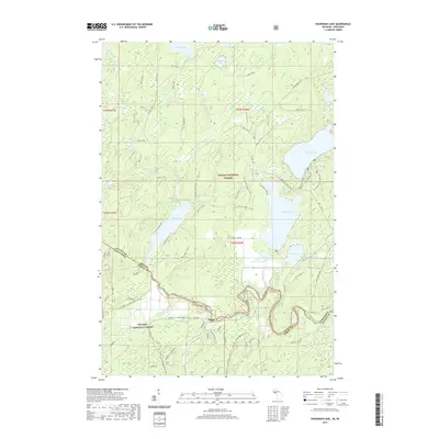
2019 Map of Hagerman Lake
USGS Topo · Published 2019About this map
Nelma sits at the intersection of forest roads and river crossings along the southern edge of this Michigan-Wisconsin borderlands survey. This 2019 data captures a landscape defined by the expansive Ottawa National Forest to the north and the Nicolet National Forest to the south. The upper portions of the Brule River serve as the jurisdictional boundary, winding through dense timber and connecting several major water bodies. Recreational infrastructure is prominent, including the Ge-Chee Ski Trail and Olson Loop, which cater to seasonal outdoor use in this remote lake country. Water features like Hagerman Lake, Ottawa Lake, and Brule Lake provide the primary geographic anchors for the region, while smaller pools such as Lake Twentytwo and Gadwall Lake dot the wetlands. The map details a complex network of forest service roads like Nfst-3117 and Nfst-3110-K that provide access to the timberlands and private parcels tucked between the protected federal forests.
Find a feature on this map
88 named features on this map. Tap any name to fly to it.
Don’t see what you’re looking for? This feature index may not catch every label — zoom into the map to look around manually.
Map Details
Editions of this 2019 Hagerman Lake Map
This is the sole edition of this map. No revisions or reprints were ever made.
Other maps of this area

1898 · Iron River
USGS Topo · 1:62,500

1938 · Alvin
USGS Topo · 1:48,000

1939 · Long Lake
USGS Topo · 1:48,000

1944 · Iron River
USGS Topo · 1:24,000

1945 · Gibbs City
USGS Topo · 1:24,000

1946 · Iron River
USGS Topo · 1:31,680

1946 · Alvin
USGS Topo · 1:48,000

1946 · Gibbs City
USGS Topo · 1:31,680

1948 · Long Lake
USGS Topo · 1:48,000

1954 · Iron Mountain
USGS Topo · 1:250,000