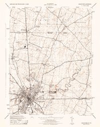
1944 Map of Hagerstown
USGS Topo · Published 1944About this map
Hagerstown anchors this 1944 survey, appearing during a period of significant wartime industrial activity. The presence of the Fairchild Aircraft Division adjacent to the Hagerstown Municipal Airport highlights the city's role in aviation production. To the north, the Pennsylvania Maryland state line bisects the community of Middleburg, where regional commerce was facilitated by the Western Maryland and Pennsylvania railroads. Along the eastern edge of the quadrangle, Antietam Creek meanders through the landscape, powering older industry at Lehmans Mill and passing near the North American Cement Corp facility. The map captures a rural-industrial balance, preserved through numerous local landmarks like the White Oak Forest School and several rural cemeteries that mark the genealogy of Washington County.
Find a feature on this map
51 named features on this map. Tap any name to fly to it.
Don’t see what you’re looking for? This feature index may not catch every label — zoom into the map to look around manually.
Map Details
Editions of this 1944 Hagerstown Map
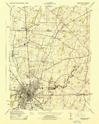
2 editions found
Other maps of this area

1900 · Mercersburg
USGS Topo · 1:62,500

1902 · Chambersburg
USGS Topo · 1:62,500

1902 · Mercersburg
USGS Topo · 1:62,500

1909 · Hagerstown
USGS Topo · 1:48,000

1912 · Hagerstown
USGS Topo · 1:62,500

1912 · Williamsport
USGS Topo · 1:62,500

1942 · Hagerstown
USGS Topo · 1:125,000

1943 · Hagerstown
USGS Topo · 1:125,000

1943 · Chambersburg
USGS Topo · 1:62,500

1943 · Mercersburg
USGS Topo · 1:62,500