
1969 Map of Haggerty Spring
USGS Topo · Published 1971About this map
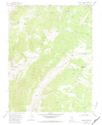
The Egan Range dominates this portion of the high desert, where water sources dictated the movement of people and livestock. This 1960s survey records a landscape defined by isolated water points such as Haggerty Spring, Stink Pot Spring, and the clustered Parker Spring group. The topography reveals a complex network of drainage systems, including Ninemile Canyon and Long Canyon, which channel seasonal runoff toward the lowlands.
Find a feature on this map
31 named features on this map. Tap any name to fly to it.
Don’t see what you’re looking for? This feature index may not catch every label — zoom into the map to look around manually.
Map Details
Editions of this 1969 Haggerty Spring Map
2 editions found
Other maps of this area

1956 · Lund
USGS Topo · 1:250,000

1960 · Lund
USGS Topo · 1:250,000

1969 · Shingle Pass
USGS Topo · 1:24,000

1969 · Moorman Spring SE
USGS Topo · 1:24,000

1969 · Parker Station
USGS Topo · 1:24,000

1969 · Shingle Pass SE
USGS Topo · 1:24,000

1969 · Moorman Spring NE
USGS Topo · 1:24,000
1977 · Bullwhack Summit
USGS Topo · 1:24,000
1977 · Brown Knoll
USGS Topo · 1:24,000
1978 · Lund
USGS Topo · 1:24,000