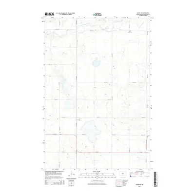
2014 Map of Hague SE
USGS Topo · Published 2014About this map
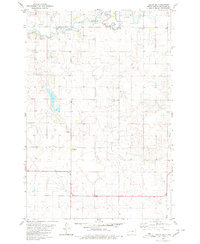
S Branch Beaver Creek meanders through the upper reaches of this McIntosh County landscape, carving a subtle path through the section lines of the northern Great Plains. The map captures a quiet rural expanse defined by a geometric grid of gravel roads and provincial highways, including the prominent bend of ND-11. Local heritage is anchored by two spiritual landmarks, Saint Andrews Cem and Saint Johns Cem, which stand as solitary sentinels of the area's early settlement history. The terrain is characterized by numerous small depressions and seasonal wetlands typical of the prairie pothole region, influencing the placement of homesteads and the winding course of the local watershed.
Find a feature on this map
19 named features on this map. Tap any name to fly to it.
Don’t see what you’re looking for? This feature index may not catch every label — zoom into the map to look around manually.
Map Details
Editions of this 2014 Hague SE Map
This is the sole edition of this map. No revisions or reprints were ever made.
Other maps of this area

1953 · Jamestown
USGS Topo · 1:250,000

1954 · Aberdeen
USGS Topo · 1:250,000

1956 · Aberdeen
USGS Topo · 1:250,000

1956 · Jamestown
USGS Topo · 1:250,000

1978 · Greenway
USGS Topo · 1:24,000

1978 · Zeeland
USGS Topo · 1:24,000
1978 · Zeeland NW
USGS Topo · 1:24,000
1980 · Hague
USGS Topo · 1:24,000
1980 · Weisser Dam West
USGS Topo · 1:24,000
1980 · Hague SE
USGS Topo · 1:24,000