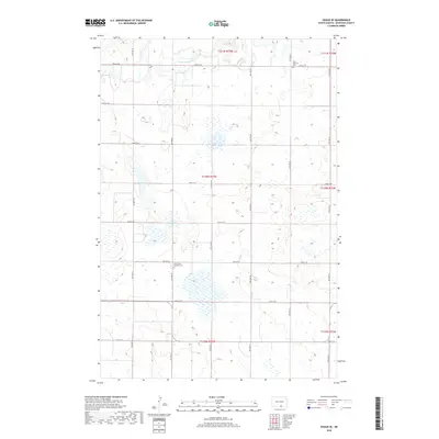
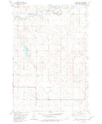
2018 Map of Hague SE
USGS Topo · Published 2018About this map
Saint Andrews Cem and Saint Johns Catholic Cem serve as quiet landmarks across this section of the Northern Great Plains in McIntosh County. The terrain is defined by a dense network of prairie potholes and wetlands, typical of the glaciated Missouri Coteau. Drainage is primarily managed by the winding South Branch Beaver Creek, which meanders through the northern townships. The landscape is structured by a rigorous section-line road grid, including 90th St SE and 97th St SE, reflecting the deep-rooted agricultural settlement patterns of the region. This 2018 survey provides a precise record of these rural sites and the intricate natural hydrology that shapes the surrounding farmland.
Find a feature on this map
17 named features on this map. Tap any name to fly to it.
Don’t see what you’re looking for? This feature index may not catch every label — zoom into the map to look around manually.
Map Details
Editions of this 2018 Hague SE Map
This is the sole edition of this map. No revisions or reprints were ever made.
Other maps of this area

1953 · Jamestown
USGS Topo · 1:250,000

1954 · Aberdeen
USGS Topo · 1:250,000

1956 · Aberdeen
USGS Topo · 1:250,000

1956 · Jamestown
USGS Topo · 1:250,000

1978 · Greenway
USGS Topo · 1:24,000

1978 · Zeeland
USGS Topo · 1:24,000
1978 · Zeeland NW
USGS Topo · 1:24,000
1980 · Hague
USGS Topo · 1:24,000
1980 · Weisser Dam West
USGS Topo · 1:24,000
1980 · Hague SE
USGS Topo · 1:24,000