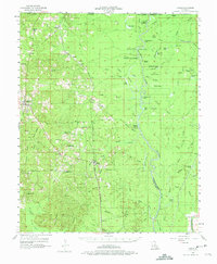
1956 Map of Haile
USGS Topo · Published 1975About this map
Marion serves as a primary hub in the mid-1950s within this Union Parish landscape, where the Missouri Pacific line and an Old Grade track the historical movement of timber and goods. The geography is defined by the complex waterways of the Ouachita River valley, characterized by distinctive wetlands such as Hog Island, Potato Patch Ridge, and Long Brake. Smaller communities like Linville and Haile are interspersed with numerous country churches and burial grounds, including Macedonia Ch and the Reppond Cem, reflecting the deep-rooted settlement patterns of northern Louisiana.
Find a feature on this map
95 named features on this map. Tap any name to fly to it.
Don’t see what you’re looking for? This feature index may not catch every label — zoom into the map to look around manually.
Map Details
Editions of this 1956 Haile Map
4 editions found

Other maps of this area

1933 · Strong
USGS Topo · 1:62,500

1934 · Felsenthal
USGS Topo · 1:62,500

1935 · Collinston
USGS Topo · 1:62,500

1935 · Naff
USGS Topo · 1:62,500

1935 · Drew
USGS Topo · 1:62,500

1935 · Haile
USGS Topo · 1:62,500

1937 · Strong
USGS Topo · 1:62,500

1937 · Felsenthal
USGS Topo · 1:62,500

1938 · Felsenthal
USGS Topo · 1:62,500

1939 · Felsenthal
USGS Topo · 1:62,500