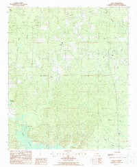
1988 Map of Haile
USGS Topo · Published 1988About this map
Linville and Haile anchor this portion of Union Parish, appearing during the late 1980s when the region's economy was heavily influenced by energy extraction. The sprawling Monroe Gas Field dominates the central landscape, showing the dense network of infrastructure required for natural gas production in northern Louisiana. This industrial footprint is overlaid upon a complex wetland environment where the meandering Bayou de Loutre flows through the southwest corner, joined by numerous tributaries such as Edwards Creek and Finch Bayou. Notable local landmarks like Buffalo Hole and the high ground of Big Island suggest a landscape where water and terrain dictated early movement and settlement patterns. To the southeast, smaller communities like Upco and Monroe are connected by a web of rural roads that navigate the creeks and drainages defining the parish.
Find a feature on this map
22 named features on this map. Tap any name to fly to it.
Don’t see what you’re looking for? This feature index may not catch every label — zoom into the map to look around manually.
Map Details
Editions of this 1988 Haile Map
This is the sole edition of this map. No revisions or reprints were ever made.
Other maps of this area

1935 · Drew
USGS Topo · 1:62,500

1935 · Haile
USGS Topo · 1:62,500

1952 · Calhoun
USGS Topo · 1:62,500

1952 · Farmerville
USGS Topo · 1:62,500

1955 · Shreveport
USGS Topo · 1:250,000

1956 · Shreveport
USGS Topo · 1:250,000

1956 · Haile
USGS Topo · 1:62,500

1957 · Monroe North
USGS Topo · 1:62,500
1969 · Monroe North
USGS Topo · 1:62,500
1982 · Point
USGS Topo · 1:24,000